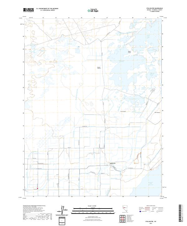
2021 Map of Stillwater
USGS Topo · Published 2021About this map
Stillwater serves as the primary hub of this high-desert wetland system, where complex water management defines the landscape in the twenty-first century. The intricate network of human-engineered channels, such as the Lead Bypass Canal and Paiute Diversion Drain, sustains a series of shallow basins including Willow Lake and East Lake. This reliance on artificial drainage systems like the Kent-Drain and S 2 Canal reveals the critical balance required to maintain these habitats within the arid Churchill County environment.
Find a feature on this map
66 named features on this map. Tap any name to fly to it.
Don’t see what you’re looking for? This feature index may not catch every label — zoom into the map to look around manually.
Map Details
Editions of this 2021 Stillwater Map
This is the sole edition of this map. No revisions or reprints were ever made.
Other maps of this area

1908 · Carson Sink
USGS Topo · 1:250,000

1910 · Carson Sink
USGS Topo · 1:250,000

1950 · Stillwater
USGS Topo · 1:62,500

1951 · Carson Lake
USGS Topo · 1:62,500

1957 · Reno
USGS Topo · 1:250,000

1959 · Reno
USGS Topo · 1:250,000

1960 · Reno
USGS Topo · 1:250,000

1969 · Pintail Bay
USGS Topo · 1:24,000

1969 · Foxtail Lake
USGS Topo · 1:24,000

1972 · Diamond Canyon
USGS Topo · 1:24,000