
1975 Map of Stillwater
USGS Topo · Published 1975About this map
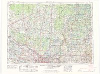
The St Croix River serves as the central artery and natural border between Minnesota and Wisconsin in this 1975 edition, reflecting the mid-century development of the region's urban and natural landscapes. In the south, the expansion of Minneapolis and St Paul is evident, showing established suburbs like Roseville and Fridley near the Twin Cities Arsenal Military Reservation. Moving north, the landscape transitions from these dense municipal centers to the extensive forests and waterways that define the river valley.
Find a feature on this map
247 named features on this map. Tap any name to fly to it.
Don’t see what you’re looking for? This feature index may not catch every label — zoom into the map to look around manually.
Map Details
Editions of this 1975 Stillwater Map
2 editions found
Other maps of this area

1896 · Minneapolis
USGS Topo · 1:62,500

1896 · St. Paul
USGS Topo · 1:62,500

1900 · St Croix Dalles
USGS Topo · 1:62,500

1901 · Minneapolis
USGS Topo · 1:62,500

1901 · St Croix Dalles
USGS Topo · 1:62,500

1902 · White Bear
USGS Topo · 1:62,500

1902 · Anoka
USGS Topo · 1:62,500

1905 · Minnetonka
USGS Topo · 1:62,500

1907 · Minnetonka
USGS Topo · 1:62,500

1909 · Rockford
USGS Topo · 1:62,500