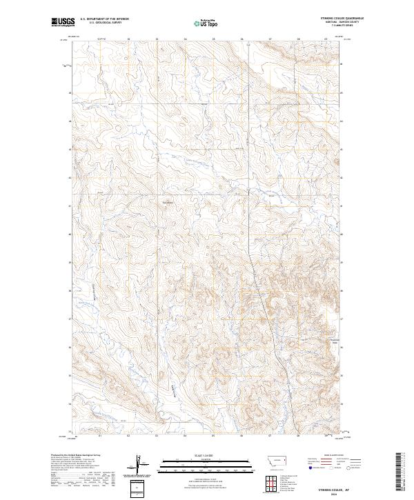
2024 Map of Stinking Coulee
USGS Topo · Published 2024About this map
Stinking Coulee winds through a landscape defined by the deep drainage networks of eastern Montana, where the watershed is split between tributaries of major regional rivers. The terrain is marked by distinctive landforms like the Twin Buttes and the flat-topped Threemile Table, which provide clear orientation points across the undulating plains. The drainage pattern is complex, with the North Fork Deer Creek and South Fork Deer Creek carving through the southern sections while Lower Sevenmile Creek and Morgan Creek dominate the north. This network of coulees and creeks, including the narrow passage of Kelley Coulee, highlights the erosion-driven topography of Dawson County. The sparse road network, characterized by routes like Fas 254 and various numbered section roads, follows the natural contours and section lines established by the Public Land Survey System, reflecting the rural and agricultural character of this modern prairie landscape.
Find a feature on this map
26 named features on this map. Tap any name to fly to it.
Don’t see what you’re looking for? This feature index may not catch every label — zoom into the map to look around manually.
Map Details
Editions of this 2024 Stinking Coulee Map
This is the sole edition of this map. No revisions or reprints were ever made.
Other maps of this area

1909 · Glendive
USGS Topo · 1:250,000

1954 · Glendive
USGS Topo · 1:250,000

1957 · Glendive
USGS Topo · 1:250,000

1958 · Glendive
USGS Topo · 1:250,000

1972 · Red Top
USGS Topo · 1:24,000

1972 · Morgan Creek School
USGS Topo · 1:24,000

1972 · Poverty Flat West
USGS Topo · 1:24,000

1972 · Bloomfield
USGS Topo · 1:24,000
1972 · Poverty Flat East
USGS Topo · 1:24,000

1972 · Stinking Coulee
USGS Topo · 1:24,000