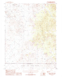
1987 Map of Stinking Spring
USGS Topo · Published 1988About this map
Golden Arrow and the surrounding high-altitude terrain of the Kawich Range dominate this 1980s topographic study. The landscape is heavily marked by mineral exploration, with numerous Prospects, Mine Shafts, and an Adit scattered across the slopes, particularly in the northern reaches where Tailings and a Quarry are also noted. These features indicate a history of hard-rock mining activity typical of Nye County's mountain ranges.
Find a feature on this map
12 named features on this map. Tap any name to fly to it.
Don’t see what you’re looking for? This feature index may not catch every label — zoom into the map to look around manually.
Map Details
Editions of this 1987 Stinking Spring Map
This is the sole edition of this map. No revisions or reprints were ever made.
Other maps of this area

1908 · Kawich
USGS Topo · 1:250,000

1942 · Cactus Range
USGS Topo · 1:125,000

1942 · Reveille Peak
USGS Topo · 1:125,000

1952 · Stinking Spring
USGS Topo · 1:62,500

1952 · Kawich Peak
USGS Topo · 1:62,500

1954 · Goldfield
USGS Topo · 1:250,000

1955 · Goldfield
USGS Topo · 1:250,000

1956 · Tonopah
USGS Topo · 1:250,000

1958 · Goldfield
USGS Topo · 1:250,000

1959 · Tonopah
USGS Topo · 1:250,000