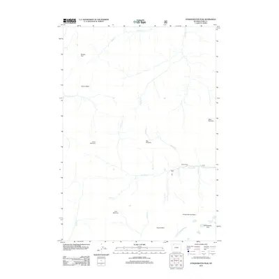
2012 Map of Stinkingwater Peak
USGS Topo · Published 2012About this map
Sunlight Mining Region anchors the southeastern corner of this high-elevation landscape in the Absaroka Range, marking a point of intersection between industrial mineral extraction and the wilderness of Northwest Wyoming. The terrain is defined by massive peaks and drainage systems, where the headwaters of the Lamar River and the N Fork Shoshone River originate from high basins like Hoodoo Basin and Hughes Basin. Small structures such as Painter Cabin and Hardee Cabins suggest a history of seasonal occupation or remote outpost management along Sunlight Cr. The map details a complex network of named creeks, including One Hunt Cr and Blackbird Cr, which carve through the elevations between prominent landmarks like Hoodoo Peak and Lamar Mountain. This 2012 survey illustrates the rugged isolation of the region, where a single road, 101, provides limited access into the heart of the mountains.
Find a feature on this map
24 named features on this map. Tap any name to fly to it.
Don’t see what you’re looking for? This feature index may not catch every label — zoom into the map to look around manually.
Map Details
Editions of this 2012 Stinkingwater Peak Map
This is the sole edition of this map. No revisions or reprints were ever made.
Other maps of this area

1896 · Crandall Creek
USGS Topo · 1:125,000

1899 · Crandall
USGS Topo · 1:125,000

1955 · Cody
USGS Topo · 1:250,000

1956 · Sunlight Peak
USGS Topo · 1:62,500

1956 · Beartooth Butte
USGS Topo · 1:62,500

1956 · Pilot Peak
USGS Topo · 1:62,500

1956 · Dead Indian Peak
USGS Topo · 1:62,500

1958 · Cody
USGS Topo · 1:250,000

1962 · Cody
USGS Topo · 1:250,000

1980 · Cody
USGS Topo · 1:100,000