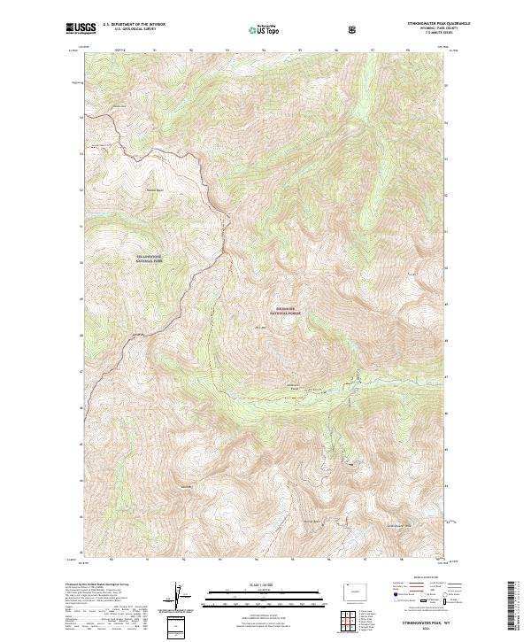
2021 Map of Stinkingwater Peak
USGS Topo · Published 2021About this map
Yellowstone National Park and Shoshone National Forest meet in this high-altitude landscape of the Absaroka Range. The terrain is defined by dramatic peaks and deep basins, including the namesake Stinkingwater Peak at the southeastern edge and Hoodoo Peak in the northwest. This modern survey illustrates the headwaters of several drainages, such as the Lamar River and the N Fork Shoshone River, which carve through the volcanic geology of the region. The map also records the exact path of primitive backcountry routes like the Hoodoo Basin Trl and the Pahaska/Sunlight Trl. These trails provide the only human-made access through significant landmarks like Hoodoo Basin and Hughes Basin, showcasing a wilderness area preserved from road development and modern encroachment.
Find a feature on this map
28 named features on this map. Tap any name to fly to it.
Don’t see what you’re looking for? This feature index may not catch every label — zoom into the map to look around manually.
Map Details
Editions of this 2021 Stinkingwater Peak Map
This is the sole edition of this map. No revisions or reprints were ever made.
Other maps of this area

1896 · Crandall Creek
USGS Topo · 1:125,000

1899 · Crandall
USGS Topo · 1:125,000

1955 · Cody
USGS Topo · 1:250,000

1956 · Sunlight Peak
USGS Topo · 1:62,500

1956 · Beartooth Butte
USGS Topo · 1:62,500

1956 · Pilot Peak
USGS Topo · 1:62,500

1956 · Dead Indian Peak
USGS Topo · 1:62,500

1958 · Cody
USGS Topo · 1:250,000

1962 · Cody
USGS Topo · 1:250,000

1980 · Cody
USGS Topo · 1:100,000