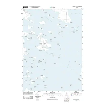
2011 Map of Stinson Neck
USGS Topo · Published 2011About this map
The coastal island landscape of eastern Maine is defined here by the intricate shoreline of Stinson Neck and the surrounding waters of Eggemoggin Reach and Jericho Bay. Situated on the southern reaches of Deer Isle, the small settlements of Sunshine and Oceanville are connected by local routes like Sunshine Rd and Black Point Rd. A significant cultural landmark, the Haystack Mountains School of Crafts, sits near the southern tip of the neck, illustrating the area's long-standing connection to the arts and education.
Find a feature on this map
118 named features on this map. Tap any name to fly to it.
Don’t see what you’re looking for? This feature index may not catch every label — zoom into the map to look around manually.
Map Details
Editions of this 2011 Stinson Neck Map
This is the sole edition of this map. No revisions or reprints were ever made.
Other maps of this area

1904 · Deer Isle
USGS Topo · 1:62,500

1904 · Mount Desert
USGS Topo · 1:62,500

1904 · Swan Island
USGS Topo · 1:62,500

1904 · Bluehill
USGS Topo · 1:62,500

1905 · Penobscot Bay
USGS Topo · 1:125,000

1942 · Mount Desert
USGS Topo · 1:62,500

1942 · Deer Isle
USGS Topo · 1:62,500

1943 · Swans Island
USGS Topo · 1:62,500

1944 · Blue Hill
USGS Topo · 1:62,500

1944 · Deer Isle
USGS Topo · 1:62,500