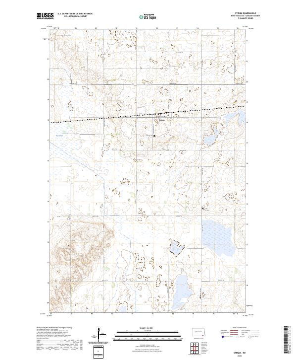
2024 Map of Stirum
USGS Topo · Published 2024About this map
The settlement of Stirum sits at the heart of this North Dakota prairie landscape, defined by a grid of rural roads and expansive wetlands. The terrain is characterized by numerous small basins and the prominent Big Slough, illustrating the terminal moraine geography of the region. Local history is anchored by the Stirum Cem and the more remote Harlem Cem, which serve as quiet markers of the area's pioneer heritage and the families who established these townships. A significant portion of the west-central area is dedicated to the Sargent County Waterfowl Production Area, reflecting the area's long-standing role as a vital corridor for migratory birds. The map details the precise township and range divisions, such as t132n r57w and t131n r56w, which governed the original homesteading and land development in Sargent County.
Find a feature on this map
24 named features on this map. Tap any name to fly to it.
Don’t see what you’re looking for? This feature index may not catch every label — zoom into the map to look around manually.
Map Details
Editions of this 2024 Stirum Map
This is the sole edition of this map. No revisions or reprints were ever made.
Other maps of this area

1952 · Crete
USGS Topo · 1:24,000

1953 · Fargo
USGS Topo · 1:250,000

1956 · Fargo
USGS Topo · 1:250,000
1956 · Straubville
USGS Topo · 1:24,000

1957 · Elliott SW
USGS Topo · 1:24,000

1957 · Stirum
USGS Topo · 1:24,000

1957 · Cogswell
USGS Topo · 1:24,000

1957 · Elliott SE
USGS Topo · 1:24,000
1958 · Forman
USGS Topo · 1:24,000

1962 · Lisbon SW
USGS Topo · 1:24,000