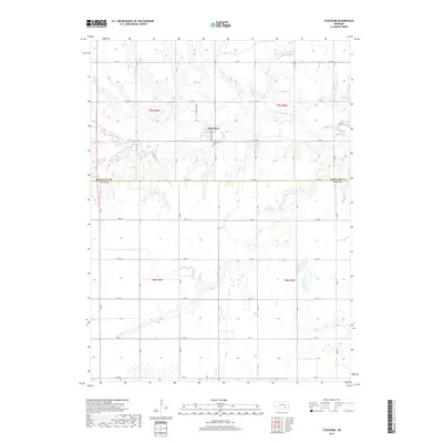
2017 Map of Stockham
USGS Topo · Published 2017About this map
The village of Stockham serves as the central hub of this agricultural landscape along the Hamilton and Clay County line. Situated in the northern half of the quadrangle, the settlement is surrounded by a dense grid of rural roads, including Grace Stockham and N Stockham Rd, that define the section-line farming pattern of the Nebraska plains. Local history is anchored by the Stockham Cem, located just south of the main cluster of buildings.
Find a feature on this map
36 named features on this map. Tap any name to fly to it.
Don’t see what you’re looking for? This feature index may not catch every label — zoom into the map to look around manually.
Map Details
Editions of this 2017 Stockham Map
This is the sole edition of this map. No revisions or reprints were ever made.
Other maps of this area

1898 · York
USGS Topo · 1:125,000

1898 · Grand Island
USGS Topo · 1:125,000

1899 · York
USGS Topo · 1:125,000

1955 · Lincoln
USGS Topo · 1:250,000

1955 · Grand Island
USGS Topo · 1:250,000

1957 · Lincoln
USGS Topo · 1:250,000

1957 · Grand Island
USGS Topo · 1:250,000

1958 · Grand Island
USGS Topo · 1:250,000

1958 · Lincoln
USGS Topo · 1:250,000
1968 · Aurora West
USGS Topo · 1:24,000