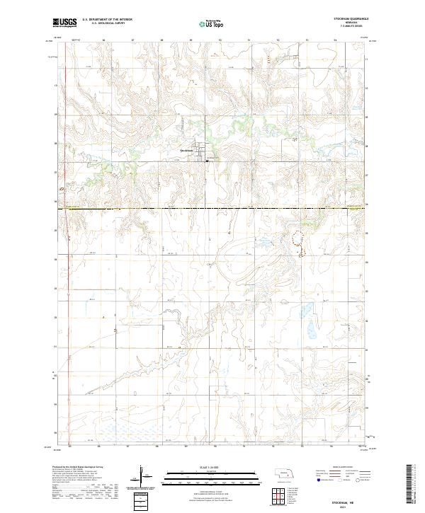
2021 Map of Stockham
USGS Topo · Published 2021About this map
Stockham anchors this agricultural landscape in southeastern Hamilton County, situated near the intersection of N Stockham Rd and E 2 Rd. The village sits just north of the county line shared by Hamilton Co and Clay Co, marked today by Rd 325. This modern topographic study reveals a terrain defined by the winding course of the West Fork Big Blue River and its various tributaries, including the N W Fork Big Blue River.
Find a feature on this map
36 named features on this map. Tap any name to fly to it.
Don’t see what you’re looking for? This feature index may not catch every label — zoom into the map to look around manually.
Map Details
Editions of this 2021 Stockham Map
This is the sole edition of this map. No revisions or reprints were ever made.
Other maps of this area

1898 · York
USGS Topo · 1:125,000

1898 · Grand Island
USGS Topo · 1:125,000

1899 · York
USGS Topo · 1:125,000

1955 · Lincoln
USGS Topo · 1:250,000

1955 · Grand Island
USGS Topo · 1:250,000

1957 · Lincoln
USGS Topo · 1:250,000

1957 · Grand Island
USGS Topo · 1:250,000

1958 · Grand Island
USGS Topo · 1:250,000

1958 · Lincoln
USGS Topo · 1:250,000
1968 · Aurora West
USGS Topo · 1:24,000