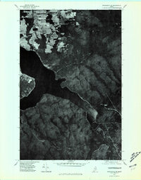
1975 Map of Stockholm NW
USGS Topo · Published 1981About this map
Long Lake dominates the central portion of this 1975 orthophotoquad, showing the intricate shoreline and surrounding timberlands of northern Aroostook County. This unique photographic record captures the landscape from a May aerial survey, revealing the high-contrast transition between cultivated agricultural plots in the northwest and the dense, unbroken forest cover to the southeast. The dark waters of the lake serve as a stark anchor for the terrain, providing a clear view of the natural inlets and points before decades of modern development. Rising from the eastern timber stands, Gold Mountain anchors the higher ground, its slopes showing the texture of the northern woods in sharp detail. Unlike traditional topographic maps, this aerial perspective allows researchers to see the actual footprint of mid-1970s land use and forest management across this section of Maine.
Find a feature on this map
2 named features on this map. Tap any name to fly to it.
Don’t see what you’re looking for? This feature index may not catch every label — zoom into the map to look around manually.
Map Details
Editions of this 1975 Stockholm NW Map
This is the sole edition of this map. No revisions or reprints were ever made.
Other maps of this area

1927 · Stockholm
USGS Topo · 1:48,000

1927 · Square Lake
USGS Topo · 1:48,000

1931 · Square Lake
USGS Topo · 1:62,500

1931 · Stockholm
USGS Topo · 1:62,500

1932 · Frenchville
USGS Topo · 1:48,000

1935 · Frenchville
USGS Topo · 1:62,500

1938 · Grand Isle
USGS Topo · 1:62,500

1940 · Grand Isle
USGS Topo · 1:62,500

1953 · Stockholm
USGS Topo · 1:62,500

1953 · Square Lake
USGS Topo · 1:62,500