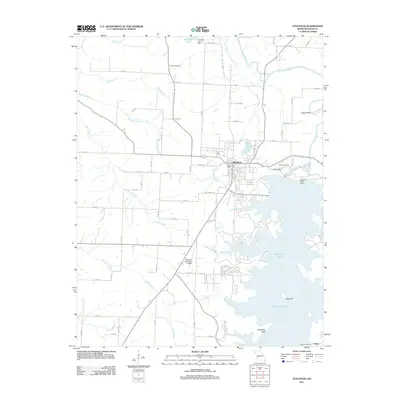
2011 Map of Stockton
USGS Topo · Published 2011About this map
Stockton Lake dominates the southern half of this landscape, its winding shoreline and numerous inlets such as Miller Branch and Cothwell Branch defining the geography south of the town of Stockton. The lake was created by the Stockton Lake Dam on the Sac River, which continues north past Cedar Bluff and Gravel Bluff. This era shows the developed recreation and infrastructure surrounding the reservoir, including the Stockton Municipal Airport and a grid of local roads like Owens Mill Rd.
Find a feature on this map
77 named features on this map. Tap any name to fly to it.
Don’t see what you’re looking for? This feature index may not catch every label — zoom into the map to look around manually.
Map Details
Editions of this 2011 Stockton Map
This is the sole edition of this map. No revisions or reprints were ever made.
Other maps of this area

1886 · Stockton
USGS Topo · 1:125,000

1939 · Caplinger Mills
USGS Topo · 1:24,000

1939 · Arnica
USGS Topo · 1:24,000

1939 · Filley
USGS Topo · 1:24,000

1940 · Filley
USGS Topo · 1:24,000

1941 · Caplinger Mills
USGS Topo · 1:24,000

1941 · Arnica
USGS Topo · 1:24,000

1954 · Springfield
USGS Topo · 1:250,000
1956 · Stockton
USGS Topo · 1:24,000
1956 · Bearcreek
USGS Topo · 1:24,000