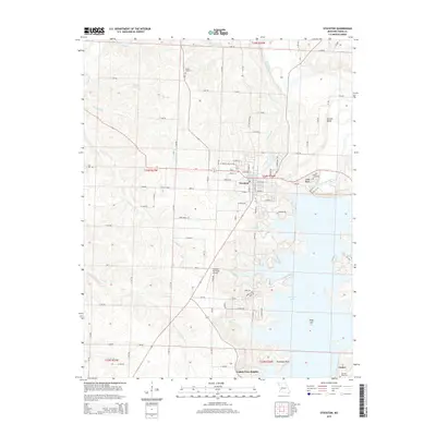
2015 Map of Stockton
USGS Topo · Published 2015About this map
Stockton serves as the central hub of this Missouri landscape, situated just north of the expansive Stockton Lake. The topography is defined by the winding course of the Sac River and its numerous tributaries, including Polecat Cr, Buckfoot Br, and Flood Br. These waterways have carved a terrain marked by distinctive elevations such as Gravel Bluff and Rudledge Bluff. The map captures the interface between the established town street grid and the encroaching waters of the reservoir, which has reshaped the local geography.
Find a feature on this map
76 named features on this map. Tap any name to fly to it.
Don’t see what you’re looking for? This feature index may not catch every label — zoom into the map to look around manually.
Map Details
Editions of this 2015 Stockton Map
This is the sole edition of this map. No revisions or reprints were ever made.
Other maps of this area

1886 · Stockton
USGS Topo · 1:125,000

1939 · Caplinger Mills
USGS Topo · 1:24,000

1939 · Arnica
USGS Topo · 1:24,000

1939 · Filley
USGS Topo · 1:24,000

1940 · Filley
USGS Topo · 1:24,000

1941 · Caplinger Mills
USGS Topo · 1:24,000

1941 · Arnica
USGS Topo · 1:24,000

1954 · Springfield
USGS Topo · 1:250,000
1956 · Stockton
USGS Topo · 1:24,000
1956 · Bearcreek
USGS Topo · 1:24,000