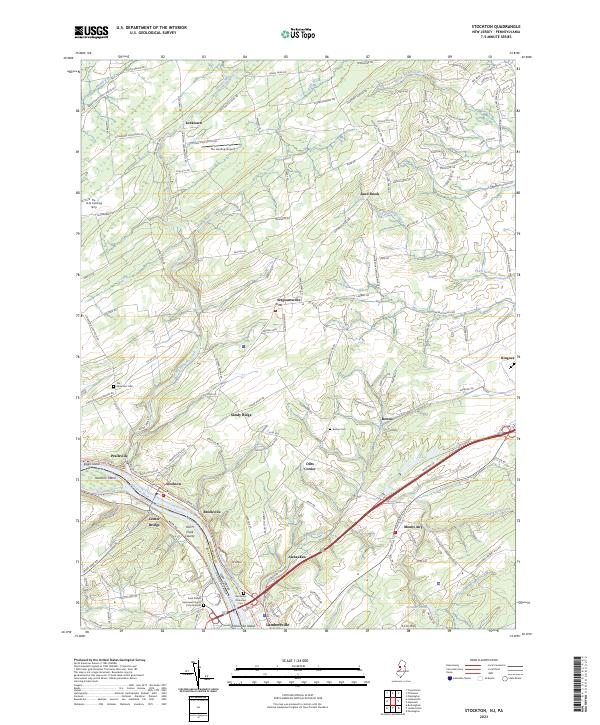
2023 Map of Stockton
USGS Topo · Published 2023About this map
The Delaware River corridor defines this landscape, where the historic Delaware and Raritan Canal on the New Jersey side and the Pennsylvania Canal on the opposite bank trace the path of nineteenth-century industrial transport. This contemporary survey shows the river's character through its many islands, including Hendrick Island, Eagle Island, and Holcombe Island. The interior of Hunterdon County is marked by a network of rural settlements such as Sergeantsville, Locktown, and Sandy Ridge, connected by winding roads that cross waterways like Wickecheoke Creek and Plum Brook. Local history is preserved in small burial grounds like Rosemont Cem and Barber Cem, while the southern edge shows the more densely developed area around Lambertville and the high ground of Mt Gilboa. Small aviation fields like The Landing Airport and the Fly-N-D Landing Strip dot the northern fields, illustrating the mix of agricultural and modern land use.
Find a feature on this map
150 named features on this map. Tap any name to fly to it.
Don’t see what you’re looking for? This feature index may not catch every label — zoom into the map to look around manually.
Map Details
Editions of this 2023 Stockton Map
This is the sole edition of this map. No revisions or reprints were ever made.
Other maps of this area

1890 · Easton
USGS Topo · 1:62,500

1890 · High Bridge
USGS Topo · 1:62,500

1890 · Lambertville
USGS Topo · 1:62,500

1890 · Doylestown
USGS Topo · 1:62,500

1891 · Easton
USGS Topo · 1:62,500

1891 · Lambertville
USGS Topo · 1:62,500

1891 · Doylestown
USGS Topo · 1:62,500

1894 · Lambertville
USGS Topo · 1:62,500

1898 · High Bridge
USGS Topo · 1:62,500

1900 · Raritan
USGS Topo · 1:125,000
Featured Places
- Raritan Township, NJ
- Solebury Township, PA
- East Amwell Township, NJ
- West Amwell Township, NJ
- Lambertville, NJ