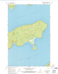
1963 Map of Stockton Island
USGS Topo · Published 1992About this map
Stockton Island dominates this mid-century topographic record of the Apostle Islands in Lake Superior. The interior of the island is designated as the Apostle Islands State Forest, containing a network of trails that connect the varied shorelines of La Pointe Township. A significant industrial remnant is visible on the southwestern coast at Quarry Bay, where a quarry sits near the water's edge, indicating the historical extraction of local sandstone.
Find a feature on this map
15 named features on this map. Tap any name to fly to it.
Don’t see what you’re looking for? This feature index may not catch every label — zoom into the map to look around manually.
Map Details
Editions of this 1963 Stockton Island Map
2 editions found
Other maps of this area

1953 · Ashland
USGS Topo · 1:250,000

1954 · Two Harbors
USGS Topo · 1:250,000

1957 · Two Harbors
USGS Topo · 1:250,000

1958 · Ashland
USGS Topo · 1:250,000

1958 · Two Harbors
USGS Topo · 1:250,000
1963 · Outer Island
USGS Topo · 1:62,500

1963 · Cat Island
USGS Topo · 1:24,000

1963 · Michigan Island
USGS Topo · 1:24,000

1963 · Rocky Island
USGS Topo · 1:62,500
1963 · Outer Island
USGS Topo · 1:24,000