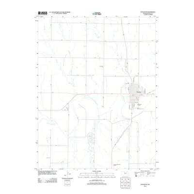
2012 Map of Stockton
USGS Topo · Published 2012About this map
Stockton serves as the focal point of this Rooks County landscape, situated along the S Fork Solomon River. The town's grid is anchored by essential local institutions, including the Po and the Rooks County Fairgrounds, with the Rooks County Speedway providing a center for local recreation. The surrounding plains are etched by numerous drainage systems, including Borin Cr, Cocklebur Cr, and Boxelder Cr, which feed toward the river valley and Lake Stockton. For those researching family history in the area, the map identifies several burial grounds such as Old Stockton Cem, Saint Thomas Cem, and the more distant Hobart Cem to the southwest. Transport and commerce are represented by the Stockton Municipal Airport and a network of section-line roads, illustrating the organized agricultural layout typical of the Kansas prairie during this early 21st-century period.
Find a feature on this map
44 named features on this map. Tap any name to fly to it.
Don’t see what you’re looking for? This feature index may not catch every label — zoom into the map to look around manually.
Map Details
Editions of this 2012 Stockton Map
This is the sole edition of this map. No revisions or reprints were ever made.
Other maps of this area

1893 · Phillipsburg
USGS Topo · 1:125,000

1896 · Plainville
USGS Topo · 1:125,000

1952 · Webster Dam
USGS Topo · 1:24,000

1953 · Woodston NW
USGS Topo · 1:24,000

1953 · Stockton
USGS Topo · 1:24,000

1955 · Beloit
USGS Topo · 1:250,000

1959 · Beloit
USGS Topo · 1:250,000

1961 · Kirwin SW
USGS Topo · 1:24,000

1969 · Stockton SW
USGS Topo · 1:24,000

1972 · Glade SW
USGS Topo · 1:24,000