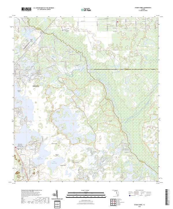
2024 Map of Stokes Ferry
USGS Topo · Published 2024About this map
The Withlacoochee River winds through the heart of this Florida landscape, defining the boundaries where Marion, Citrus, and Sumter counties converge. Historically significant as a river crossing, Stokes Ferry sits at the northern reaches, while the town of Hernando anchor the southwestern portion of the sheet. The terrain is dominated by the intricate wetlands and islands of the Tsala Apopka Lake system, including named landforms like Spooner Island, Gilchrist Island, and Briggs Island. These areas are interlaced with conservation and recreation corridors, notably the Potts Preserve Trl and the Half Moon Gum Slough Trail, which navigate the dense vegetation of Gum Swamp and the waterways of Gum Slough. Small private aviation facilities like Drake Ranch Airport and Twelve Oaks Airport suggest the modern land use patterns and rural estates characteristic of the region.
Find a feature on this map
58 named features on this map. Tap any name to fly to it.
Don’t see what you’re looking for? This feature index may not catch every label — zoom into the map to look around manually.
Map Details
Editions of this 2024 Stokes Ferry Map
This is the sole edition of this map. No revisions or reprints were ever made.
Other maps of this area

1892 · Dunnellon
USGS Topo · 1:62,500

1893 · Panasoffkee
USGS Topo · 1:62,500

1894 · Dunnellon
USGS Topo · 1:62,500

1895 · Tsala Apopka
USGS Topo · 1:62,500

1895 · Panasoffkee
USGS Topo · 1:62,500

1895 · Ocala
USGS Topo · 1:62,500

1954 · Lecanto
USGS Topo · 1:24,000

1954 · Holder
USGS Topo · 1:24,000

1954 · Tsala Apopka NE
USGS Topo · 1:24,000

1954 · Dunnellon
USGS Topo · 1:24,000