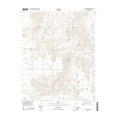
2015 Map of Stokes Mountain
USGS Topo · Published 2015About this map
Stokes Mtn and the neighboring Sawyer Peak anchor the transition between the rising Sierra Nevada foothills and the fertile lowlands of the San Joaquin Valley. This modern survey reveals a landscape defined by the critical movement of water through the Friant-Kern Canal and the Alta E Br Canal, which irrigate the agricultural reaches of Woodlake Valley. The complex topography is marked by deeply cut drainages such as Stone Corral Canyon and Wilcox Canyon, where seasonal flows like Moore Cr and Grapevine Cr descend from the peaks. The map provides a detailed view of the rural road network, showing the grid-like development of avenues and roads that serve the orchards and ranches at the base of Cliff Peak and Curtis Mtn.
Find a feature on this map
58 named features on this map. Tap any name to fly to it.
Don’t see what you’re looking for? This feature index may not catch every label — zoom into the map to look around manually.
Map Details
Editions of this 2015 Stokes Mountain Map
This is the sole edition of this map. No revisions or reprints were ever made.
Other maps of this area

1921 · Squaw Valley
USGS Topo · 1:31,680

1921 · Stokes Mountain
USGS Topo · 1:24,000

1922 · Trimmer
USGS Topo · 1:96,000

1923 · Sultana
USGS Topo · 1:31,680

1924 · Citrus Cove
USGS Topo · 1:31,680

1924 · Dinuba
USGS Topo · 1:125,000

1924 · Stokes Mountain
USGS Topo · 1:31,680

1926 · Ivanhoe
USGS Topo · 1:31,680

1927 · Monson
USGS Topo · 1:31,680

1928 · Lemon Cove
USGS Topo · 1:31,680