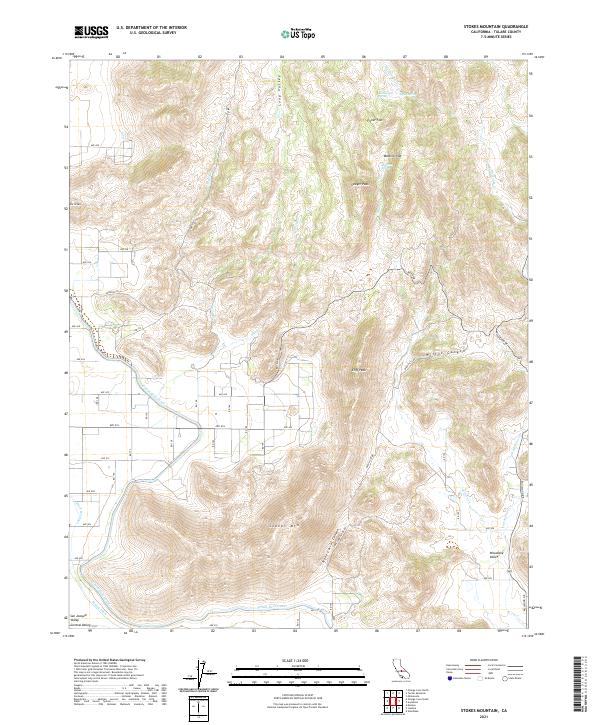
2021 Map of Stokes Mountain
USGS Topo · Published 2021About this map
Stokes Mountain and its surrounding peaks define this portion of the Sierra Nevada foothills where the highlands meet the eastern edge of the San Joaquin Valley. This 2021 survey by the U.S. Geological Survey illustrates the transition from the steep, spring-fed canyons of the mountain range to the irrigated agricultural lands of the Central Valley. The map detail follows the path of the Friant-Kern Canal as it skirts the western base of the mountains, a vital piece of water infrastructure that supports the orchards and fields of the Woodlake Valley.
Find a feature on this map
63 named features on this map. Tap any name to fly to it.
Don’t see what you’re looking for? This feature index may not catch every label — zoom into the map to look around manually.
Map Details
Editions of this 2021 Stokes Mountain Map
This is the sole edition of this map. No revisions or reprints were ever made.
Other maps of this area

1921 · Squaw Valley
USGS Topo · 1:31,680

1921 · Stokes Mountain
USGS Topo · 1:24,000

1922 · Trimmer
USGS Topo · 1:96,000

1923 · Sultana
USGS Topo · 1:31,680

1924 · Citrus Cove
USGS Topo · 1:31,680

1924 · Dinuba
USGS Topo · 1:125,000

1924 · Stokes Mountain
USGS Topo · 1:31,680

1926 · Ivanhoe
USGS Topo · 1:31,680

1927 · Monson
USGS Topo · 1:31,680

1928 · Lemon Cove
USGS Topo · 1:31,680