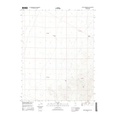
2014 Map of Stone Cabin Ranch SE
USGS Topo · Published 2014About this map
Stone Cabin Valley dominates the high desert landscape of central Nye County, where wide alluvial basins meet the rising slopes of the Kawich Range. This 2014 topographic survey details a remote area defined by ephemeral water sources and rugged canyons. The presence of Haws Canyon Spring and Haws Canyon Spring Number One indicates the vital points of water that historically dictated movement through these arid corridors. On the eastern edge of the valley, the terrain narrows into Bellehelen Canyon and Haws Canyon, while Willow Cr provides a subtle drainage path in the northwestern corner. The map documents the vast public land survey system grid, reflecting the enduring administrative structure of the Nevada backcountry.
Find a feature on this map
11 named features on this map. Tap any name to fly to it.
Don’t see what you’re looking for? This feature index may not catch every label — zoom into the map to look around manually.
Map Details
Editions of this 2014 Stone Cabin Ranch SE Map
This is the sole edition of this map. No revisions or reprints were ever made.
Other maps of this area

1908 · Kawich
USGS Topo · 1:250,000

1942 · Cactus Range
USGS Topo · 1:125,000

1942 · Reveille Peak
USGS Topo · 1:125,000

1952 · Stinking Spring
USGS Topo · 1:62,500

1952 · Kawich Peak
USGS Topo · 1:62,500

1954 · Goldfield
USGS Topo · 1:250,000

1955 · Goldfield
USGS Topo · 1:250,000

1956 · Tonopah
USGS Topo · 1:250,000

1958 · Goldfield
USGS Topo · 1:250,000

1959 · Tonopah
USGS Topo · 1:250,000