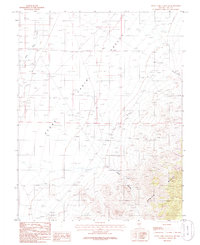
1986 Map of Stone Cabin Ranch SE
USGS Topo · Published 1986About this map
Stone Cabin Valley dominates this high-desert terrain, a wide alluvial basin defined by the north-south flow of Stone Cabin Creek. To the east, the topography rises sharply into the Kawich Range, where the landscape is carved by steep drainage systems like Haws Canyon and Bellehelen Canyon. These canyons provide the primary access points into the rugged mountain interior from the valley floor.
Find a feature on this map
7 named features on this map. Tap any name to fly to it.
Don’t see what you’re looking for? This feature index may not catch every label — zoom into the map to look around manually.
Map Details
Editions of this 1986 Stone Cabin Ranch SE Map
This is the sole edition of this map. No revisions or reprints were ever made.
Other maps of this area

1908 · Kawich
USGS Topo · 1:250,000

1942 · Cactus Range
USGS Topo · 1:125,000

1942 · Reveille Peak
USGS Topo · 1:125,000

1952 · Stinking Spring
USGS Topo · 1:62,500

1952 · Kawich Peak
USGS Topo · 1:62,500

1954 · Goldfield
USGS Topo · 1:250,000

1955 · Goldfield
USGS Topo · 1:250,000

1956 · Tonopah
USGS Topo · 1:250,000

1958 · Goldfield
USGS Topo · 1:250,000

1959 · Tonopah
USGS Topo · 1:250,000