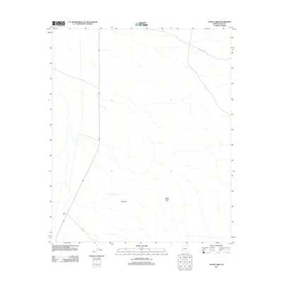
2011 Map of Stone Cabin
USGS Topo · Published 2011About this map
Stone Cabin marks a lonely intersection in the arid expanses of Yuma County, positioned where the modern highway corridor meets the historic reach of King Rd. This high desert terrain is defined by dramatic elevation changes, with the prominent silhouette of High Peak overlooking the surrounding landscape. To the east, the Hidden Valley Hills create a natural barrier, housing the Hidden Valley Tanks, which suggest the critical importance of water management in this parched environment. The presence of Palm Canyon Rd in the northeast quadrant indicates a route toward the deeper mountain recesses, while the map as a whole reveals a landscape of sparse infrastructure typical of the Arizona desert at the start of the twenty-first century.
Find a feature on this map
6 named features on this map. Tap any name to fly to it.
Don’t see what you’re looking for? This feature index may not catch every label — zoom into the map to look around manually.
Map Details
Editions of this 2011 Stone Cabin Map
This is the sole edition of this map. No revisions or reprints were ever made.
Other maps of this area

1934 · Trigo Peaks
USGS Topo · 1:48,000

1939 · Red Hill
USGS Topo · 1:62,500

1939 · Trigo Peaks
USGS Topo · 1:62,500

1942 · Blythe
USGS Topo · 1:250,000

1954 · Salton Sea
USGS Topo · 1:250,000

1954 · Red Hill
USGS Topo · 1:62,500

1954 · Trigo Peaks
USGS Topo · 1:62,500

1955 · Salton Sea
USGS Topo · 1:250,000

1959 · Salton Sea
USGS Topo · 1:250,000
1962 · Livingston Hills
USGS Topo · 1:62,500