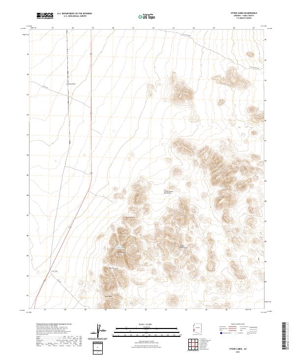
2021 Map of Stone Cabin
USGS Topo · Published 2021About this map
Stone Cabin sits along the western edge of this desert landscape, serving as a primary point of interest in a region defined by the transition from open flats to high peaks. The terrain is dominated by the Castle Dome Mountains to the east, where the elevation rises sharply toward High Peak. This area of the La Posa Plain is crisscrossed by several desert routes, including Cibola Rd and King Rd, which provided essential access for ranching and mining interests throughout the 20th century.
Find a feature on this map
15 named features on this map. Tap any name to fly to it.
Don’t see what you’re looking for? This feature index may not catch every label — zoom into the map to look around manually.
Map Details
Editions of this 2021 Stone Cabin Map
This is the sole edition of this map. No revisions or reprints were ever made.
Other maps of this area

1934 · Trigo Peaks
USGS Topo · 1:48,000

1939 · Red Hill
USGS Topo · 1:62,500

1939 · Trigo Peaks
USGS Topo · 1:62,500

1942 · Blythe
USGS Topo · 1:250,000

1954 · Salton Sea
USGS Topo · 1:250,000

1954 · Red Hill
USGS Topo · 1:62,500

1954 · Trigo Peaks
USGS Topo · 1:62,500

1955 · Salton Sea
USGS Topo · 1:250,000

1959 · Salton Sea
USGS Topo · 1:250,000
1962 · Livingston Hills
USGS Topo · 1:62,500