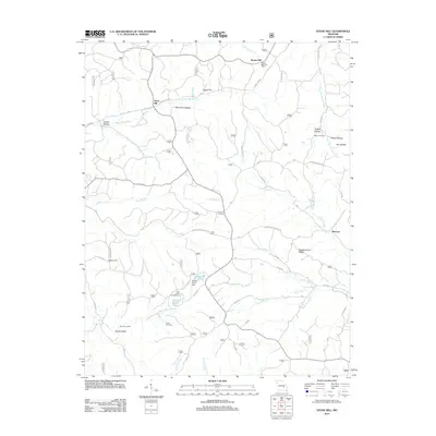
2012 Map of Stone Hill
USGS Topo · Published 2012About this map
Howes Mill and the Howes Mill Post Office anchor the northern landscape of this Dent County region, where the terrain is defined by a dense network of hollows and ridges. To the west, the settlement of Stone Hill sits near the headwaters of the Stone Hill Branch, while the southeastern corner is shaped by the waters of the Meramec River and Sinking Creek. The area's social and community history is preserved in sites like Scotia Cemetery, Parker Cemetery, and Brook Cemetery, alongside evidence of historical water management at Bishop Dam and Scotia Pond Dam. Recreation and conservation are centered around the Little Scotia Campground and the elevated Marcot Lookout, which provides a vantage point over the complex topography of Stooping Tree Ridge and the various branches of West Fork Huzzah Creek.
Find a feature on this map
37 named features on this map. Tap any name to fly to it.
Don’t see what you’re looking for? This feature index may not catch every label — zoom into the map to look around manually.
Map Details
Editions of this 2012 Stone Hill Map
This is the sole edition of this map. No revisions or reprints were ever made.
Other maps of this area

1941 · Stone Hill
USGS Topo · 1:62,500

1943 · Boss
USGS Topo · 1:62,500

1944 · Corridon
USGS Topo · 1:62,500

1945 · Stone Hill
USGS Topo · 1:62,500

1945 · Round Spring
USGS Topo · 1:62,500

1946 · Boss
USGS Topo · 1:62,500

1947 · Sinkin
USGS Topo · 1:48,000

1947 · Corridon
USGS Topo · 1:62,500

1949 · Round Spring
USGS Topo · 1:62,500

1949 · Rolla
USGS Topo · 1:250,000