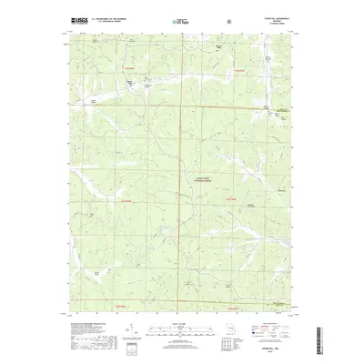
2017 Map of Stone Hill
USGS Topo · Published 2017About this map
Howes Mill and Stone Hill anchor the northern landscape of this Missouri Ozarks region within the Mark Twain National Forest. The topography is defined by a dense network of hollows, including Bell Hollow, Levi Hollow, and MacIntire Hollow, which channel various branches toward the Meramec River and Sinking Cr. This 2017 survey reveals the quiet persistence of historic community sites, evidenced by the concentration of family and school burial grounds like the Nelson Schoolyard Graveyard and Parker Cem. To the south, the terrain descends into Scotia Valley, a distinctive pocket containing Scotia Pond and Little Scotia Pond. The map also traces modern transit corridors such as State Hwy 8 and the Karkaughne Scenic Dr as they navigate the ridges and gaps between Dent and Reynolds counties.
Find a feature on this map
63 named features on this map. Tap any name to fly to it.
Don’t see what you’re looking for? This feature index may not catch every label — zoom into the map to look around manually.
Map Details
Editions of this 2017 Stone Hill Map
This is the sole edition of this map. No revisions or reprints were ever made.
Other maps of this area

1941 · Stone Hill
USGS Topo · 1:62,500

1943 · Boss
USGS Topo · 1:62,500

1944 · Corridon
USGS Topo · 1:62,500

1945 · Stone Hill
USGS Topo · 1:62,500

1945 · Round Spring
USGS Topo · 1:62,500

1946 · Boss
USGS Topo · 1:62,500

1947 · Sinkin
USGS Topo · 1:48,000

1947 · Corridon
USGS Topo · 1:62,500

1949 · Round Spring
USGS Topo · 1:62,500

1949 · Rolla
USGS Topo · 1:250,000