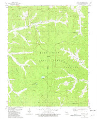
1981 Map of Stone Hill
USGS Topo · Published 1982About this map
Scotia Iron Mine and its nearby campground anchor the southern reaches of this landscape, reflecting the region's historical industrial activity within the Scotia Valley. The settlement of Stone Hill serves as a local focal point, supported by the Stone Hill Ch and several family burial grounds including Brook Cem and Scotia Cem. To the northeast, Howes Mill sits near the headwaters of Huzzah Creek, while the Meramec River flows through the western terrain. The area is heavily defined by the Mark Twain National Forest, where the Marcoot Lookout Tower stands atop a ridge. A complex network of drainage hollows, such as MacIntire Hollow and Teague Hollow, carve through the Ozark topography, illustrating the intricate watershed that feeds into Sinking Creek.
Find a feature on this map
42 named features on this map. Tap any name to fly to it.
Don’t see what you’re looking for? This feature index may not catch every label — zoom into the map to look around manually.
Map Details
Editions of this 1981 Stone Hill Map
This is the sole edition of this map. No revisions or reprints were ever made.
Other maps of this area

1941 · Stone Hill
USGS Topo · 1:62,500

1943 · Boss
USGS Topo · 1:62,500

1944 · Corridon
USGS Topo · 1:62,500

1945 · Stone Hill
USGS Topo · 1:62,500

1945 · Round Spring
USGS Topo · 1:62,500

1946 · Boss
USGS Topo · 1:62,500

1947 · Sinkin
USGS Topo · 1:48,000

1947 · Corridon
USGS Topo · 1:62,500

1949 · Round Spring
USGS Topo · 1:62,500

1949 · Rolla
USGS Topo · 1:250,000