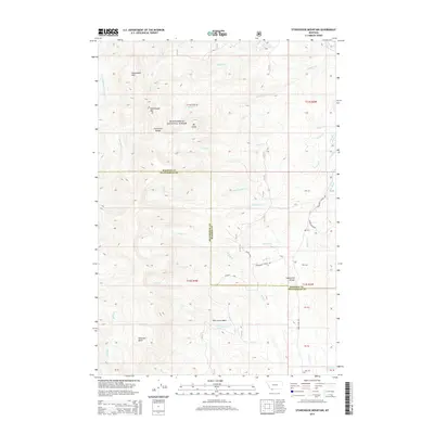
2014 Map of Stonehouse Mountain
USGS Topo · Published 2014About this map
Stonehouse Mtn and the Snowcrest Range anchor this portion of the Beaverhead National Forest along the border of Beaverhead and Madison counties. The high-elevation terrain is defined by a series of prominent basins and parks, including Honeymoon Park, Peterson Basin, and Pole Creek Basin. A complex network of drainage systems radiates from the divides, with the Ruby River flowing through the eastern reaches while the E Fork Blacktail Deer Cr drains the northwestern slopes. Human activity is represented primarily by primitive routes and forest management markers, such as the Centennial Divide Rd and the Gilbert Trl. The map also captures the significant topographical transition at the Centennial Divide, where the landscape is carved by numerous creeks like Hawkeye Cr and Shovel Cr.
Find a feature on this map
48 named features on this map. Tap any name to fly to it.
Don’t see what you’re looking for? This feature index may not catch every label — zoom into the map to look around manually.
Map Details
Editions of this 2014 Stonehouse Mountain Map
This is the sole edition of this map. No revisions or reprints were ever made.
Other maps of this area

1950 · Lower Red Rock Lake
USGS Topo · 1:62,500

1950 · Monument Ridge
USGS Topo · 1:62,500

1955 · Dubois
USGS Topo · 1:250,000

1955 · Ashton
USGS Topo · 1:250,000

1958 · Dubois
USGS Topo · 1:250,000

1958 · Ashton
USGS Topo · 1:250,000

1960 · Ashton
USGS Topo · 1:250,000

1968 · Stonehouse Mountain
USGS Topo · 1:24,000

1968 · Antelope Peak
USGS Topo · 1:24,000

1968 · Antone Peak
USGS Topo · 1:24,000