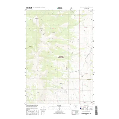
2017 Map of Stonehouse Mountain
USGS Topo · Published 2017About this map
Stonehouse Mountain dominates the high elevation of the Snowcrest Range in this section of the Beaverhead National Forest. This high country map defines a watershed boundary between the Madison and Beaverhead county lines, where the Centennial Divide separates drainage between numerous creeks. Several distinct alpine meadows and basins are mapped, including Honeymoon Park and Peterson Basin.
Find a feature on this map
51 named features on this map. Tap any name to fly to it.
Don’t see what you’re looking for? This feature index may not catch every label — zoom into the map to look around manually.
Map Details
Editions of this 2017 Stonehouse Mountain Map
This is the sole edition of this map. No revisions or reprints were ever made.
Other maps of this area

1950 · Lower Red Rock Lake
USGS Topo · 1:62,500

1950 · Monument Ridge
USGS Topo · 1:62,500

1955 · Dubois
USGS Topo · 1:250,000

1955 · Ashton
USGS Topo · 1:250,000

1958 · Dubois
USGS Topo · 1:250,000

1958 · Ashton
USGS Topo · 1:250,000

1960 · Ashton
USGS Topo · 1:250,000

1968 · Stonehouse Mountain
USGS Topo · 1:24,000

1968 · Antelope Peak
USGS Topo · 1:24,000

1968 · Antone Peak
USGS Topo · 1:24,000