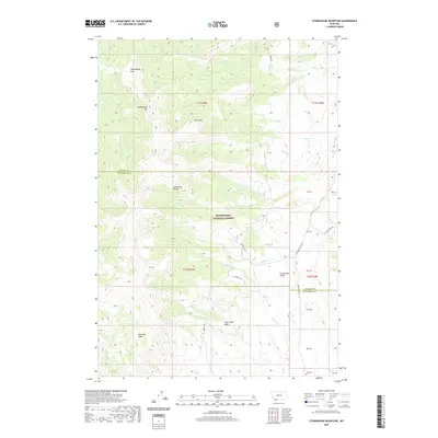
2020 Map of Stonehouse Mountain
USGS Topo · Published 2020About this map
Stonehouse Mtn and the high elevations of the Snowcrest Range dominate this corner of the Beaverhead National Forest along the border of Madison and Beaverhead counties. The landscape is defined by its drainage systems, where headwaters such as the Ruby River and E Fork Blacktail Deer Cr begin their descent. High mountain meadows and basins like Honeymoon Park, Peterson Basin, and Pole Creek Basin provide clear evidence of the area's grazing and wilderness character. The eastern portion of the map highlights the Centennial Divide, a significant geographic marker near which remote routes like Centennial Divide Rd and Ruby Divide Rd snake through the terrain. Evidence of back-country access is visible through the Gilbert Trl, which connects these high basins across a network of named peaks including Mt Carey.
Find a feature on this map
49 named features on this map. Tap any name to fly to it.
Don’t see what you’re looking for? This feature index may not catch every label — zoom into the map to look around manually.
Map Details
Editions of this 2020 Stonehouse Mountain Map
This is the sole edition of this map. No revisions or reprints were ever made.
Other maps of this area

1950 · Lower Red Rock Lake
USGS Topo · 1:62,500

1950 · Monument Ridge
USGS Topo · 1:62,500

1955 · Dubois
USGS Topo · 1:250,000

1955 · Ashton
USGS Topo · 1:250,000

1958 · Dubois
USGS Topo · 1:250,000

1958 · Ashton
USGS Topo · 1:250,000

1960 · Ashton
USGS Topo · 1:250,000

1968 · Stonehouse Mountain
USGS Topo · 1:24,000

1968 · Antelope Peak
USGS Topo · 1:24,000

1968 · Antone Peak
USGS Topo · 1:24,000