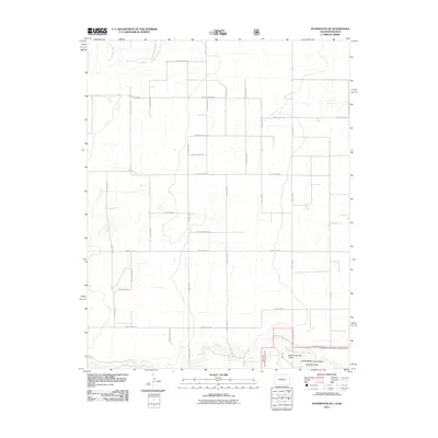
2011 Map of Stonington SE
USGS Topo · Published 2011About this map
The Cimarron National Grassland dominates the southern reaches of this landscape in southeastern Baca County, where the North Fork Cimarron River winds through the grasslands near the state line. The terrain is defined by a rigorous grid of section lines and gravel paths, including County Road BB and County Road Z, which facilitate movement through this high plains ranching and agricultural environment. In the northern section, the ephemeral drainage of Sand Arroyo Creek cuts across the plains, reflecting the semi-arid nature of the region. The map illustrates a contemporary livestock management system, notably marked by designated areas such as Pasture Number Three. This 2011 survey captures a remote portion of Colorado where the geometric order of county roads meets the natural curves of the river system.
Find a feature on this map
27 named features on this map. Tap any name to fly to it.
Don’t see what you’re looking for? This feature index may not catch every label — zoom into the map to look around manually.
Map Details
Editions of this 2011 Stonington SE Map
This is the sole edition of this map. No revisions or reprints were ever made.
Other maps of this area

1892 · Vilas
USGS Topo · 1:125,000

1955 · La Junta
USGS Topo · 1:250,000

1955 · Dodge City
USGS Topo · 1:250,000

1958 · La Junta
USGS Topo · 1:250,000

1958 · Dodge City
USGS Topo · 1:250,000

1959 · Dodge City
USGS Topo · 1:250,000

1968 · La Junta
USGS Topo · 1:250,000

1973 · Richfield NW
USGS Topo · 1:24,000
1973 · Richfield SW
USGS Topo · 1:24,000
1973 · Elkhart NW
USGS Topo · 1:24,000