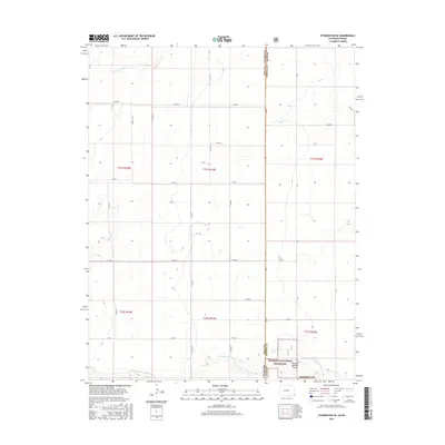
2016 Map of Stonington SE
USGS Topo · Published 2016About this map
The high plains borderland between Baca County, Colorado, and Morton County, Kansas, is defined by the sharp transition from agricultural sections to the protected terrain of the Cimarron National Grassland. In the southern portion of the map, the N Fork Cimarron River meanders through the grassland, carved into a landscape that includes specific management zones like Pasture Number Three. The northern territory is dominated by the geometric precision of the Public Land Survey System, where a network of county roads such as Co RD 88 and Co RD Z divide the open range. Water is a scarce but vital feature here, represented by the ephemeral Sand Arroyo Cr and several unnamed seasonal depressions. This 2016 survey documents a rural landscape where the economy is clearly tied to both private ranching and federal land management along the Colorado-Kansas state line.
Find a feature on this map
32 named features on this map. Tap any name to fly to it.
Don’t see what you’re looking for? This feature index may not catch every label — zoom into the map to look around manually.
Map Details
Editions of this 2016 Stonington SE Map
This is the sole edition of this map. No revisions or reprints were ever made.
Other maps of this area

1892 · Vilas
USGS Topo · 1:125,000

1955 · La Junta
USGS Topo · 1:250,000

1955 · Dodge City
USGS Topo · 1:250,000

1958 · La Junta
USGS Topo · 1:250,000

1958 · Dodge City
USGS Topo · 1:250,000

1959 · Dodge City
USGS Topo · 1:250,000

1968 · La Junta
USGS Topo · 1:250,000

1973 · Richfield NW
USGS Topo · 1:24,000
1973 · Richfield SW
USGS Topo · 1:24,000
1973 · Elkhart NW
USGS Topo · 1:24,000