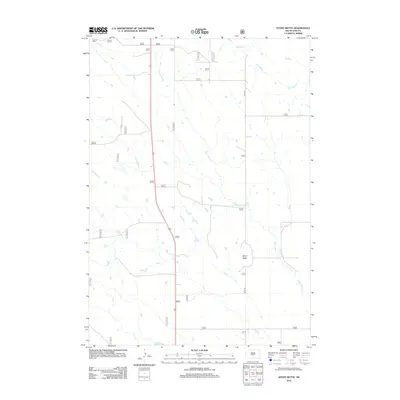
2012 Map of Stony Butte
USGS Topo · Published 2012About this map
Stony Butte rises as a prominent landmark in this Jones County landscape, overlooking a network of seasonal watercourses that define the local geography. The area's drainage pattern is dominated by Stony Butte Cr, which winds across the central and southern portions of the territory, while Cedar Cr and S Br Cedar Cr mark the northern reaches. Summit Reservoir serves as a critical water management feature in an area otherwise characterized by these intermittent prairie streams, including E Br War Cr. This 2012 survey illustrates the sparse human footprint in this part of South Dakota, where the primary infrastructure consists of solitary routes like Co RD 27 cutting through the open terrain. The map provides a clear look at the relationship between these essential water sources and the land's natural contours during the early 21st century.
Find a feature on this map
7 named features on this map. Tap any name to fly to it.
Don’t see what you’re looking for? This feature index may not catch every label — zoom into the map to look around manually.
Map Details
Editions of this 2012 Stony Butte Map
This is the sole edition of this map. No revisions or reprints were ever made.
Other maps of this area

1953 · Pierre 3 NW
USGS Topo · 1:24,000

1954 · Pierre
USGS Topo · 1:250,000

1955 · Martin
USGS Topo · 1:250,000

1958 · Pierre
USGS Topo · 1:250,000

1958 · Martin
USGS Topo · 1:250,000

1967 · Ft. George Butte NW
USGS Topo · 1:24,000

1967 · Ft. George Butte SW
USGS Topo · 1:24,000

1972 · Pierre 3 SW
USGS Topo · 1:24,000

1972 · Pierre 3 SE
USGS Topo · 1:24,000

1972 · Vivian
USGS Topo · 1:24,000