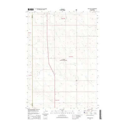
2015 Map of Stony Butte
USGS Topo · Published 2015About this map
Ft. Pierre National Grassland dominates this central South Dakota landscape, providing a preserved expanse of prairie within the Missouri Plateau. The map captures the subtle drainage patterns of the region, where Stony Butte Cr and its tributaries carve winding paths through the grassland towards Cedar Cr. The eponymous Stony Butte serves as a prominent landmark in an otherwise gently undulating terrain, offering a rare point of elevation near the boundary of Jones and Lyman counties. Sparse human infrastructure is limited to the north-south corridor of Route 83 and local routes like Co Rd 27, highlighting the open, ranch-oriented character of this rural area. Small water features such as Summit Reservoir underscore the importance of water management in this semi-arid environment, where natural creeks like E Br War Cr are essential to the local ecosystem.
Find a feature on this map
15 named features on this map. Tap any name to fly to it.
Don’t see what you’re looking for? This feature index may not catch every label — zoom into the map to look around manually.
Map Details
Editions of this 2015 Stony Butte Map
This is the sole edition of this map. No revisions or reprints were ever made.
Other maps of this area

1953 · Pierre 3 NW
USGS Topo · 1:24,000

1954 · Pierre
USGS Topo · 1:250,000

1955 · Martin
USGS Topo · 1:250,000

1958 · Pierre
USGS Topo · 1:250,000

1958 · Martin
USGS Topo · 1:250,000

1967 · Ft. George Butte NW
USGS Topo · 1:24,000

1967 · Ft. George Butte SW
USGS Topo · 1:24,000

1972 · Pierre 3 SW
USGS Topo · 1:24,000

1972 · Pierre 3 SE
USGS Topo · 1:24,000

1972 · Vivian
USGS Topo · 1:24,000