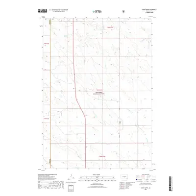
2017 Map of Stony Butte
USGS Topo · Published 2017About this map
Fort Pierre National Grassland dominates this section of the South Dakota plains, where the open landscape is defined by its drainage systems and subtle elevations. The terrain is marked by the distinctive Stony Butte, a high point overlooking the winding course of Stony Butte Cr and the intermittent flow of Cedar Cr. This map captures the rural character of the region on the border of Jones and Lyman counties, where human infrastructure is limited primarily to ranching-related features like the Summit Reservoir and the long, straight north-south corridor of Route 83. The network of section lines and secondary roads such as Co RD 27 illustrates the organized grid of the public land survey system, providing a structural framework for this expansive grassland environment.
Find a feature on this map
15 named features on this map. Tap any name to fly to it.
Don’t see what you’re looking for? This feature index may not catch every label — zoom into the map to look around manually.
Map Details
Editions of this 2017 Stony Butte Map
This is the sole edition of this map. No revisions or reprints were ever made.
Other maps of this area

1953 · Pierre 3 NW
USGS Topo · 1:24,000

1954 · Pierre
USGS Topo · 1:250,000

1955 · Martin
USGS Topo · 1:250,000

1958 · Pierre
USGS Topo · 1:250,000

1958 · Martin
USGS Topo · 1:250,000

1967 · Ft. George Butte NW
USGS Topo · 1:24,000

1967 · Ft. George Butte SW
USGS Topo · 1:24,000

1972 · Pierre 3 SW
USGS Topo · 1:24,000

1972 · Pierre 3 SE
USGS Topo · 1:24,000

1972 · Vivian
USGS Topo · 1:24,000