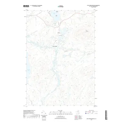
2019 Map of Stony Creek Mountain
USGS Topo · Published 2019About this map
The Raquette River winds through this Adirondack landscape, connecting the southern reaches near Raquette Falls to the established landing at Axton Landing. This 2019 survey documents a region defined by its water routes and mountain passes, where the portage history is preserved in the naming of Indian Carry Rd near the southern tip of Upper Saranac Lake. The map details the topography surrounding Stony Creek Mtn and the isolated waters of Follensby Pond. Small settlements like Coreys serve as nodes in a network of seasonal roads including Coreys Rd and Stony Creek Rd. This modern topographical record shows how historical transit points like Chapel Island and Corey Island remain central landmarks in the Franklin County wilderness, maintaining a spatial layout that has dictated travel in these woods for generations.
Find a feature on this map
25 named features on this map. Tap any name to fly to it.
Don’t see what you’re looking for? This feature index may not catch every label — zoom into the map to look around manually.
Map Details
Editions of this 2019 Stony Creek Mountain Map
This is the sole edition of this map. No revisions or reprints were ever made.
Other maps of this area

1902 · Saranac
USGS Topo · 1:62,500

1904 · Saranac
USGS Topo · 1:62,500

1904 · Santanoni
USGS Topo · 1:62,500

1904 · Long Lake
USGS Topo · 1:62,500

1905 · Saint Regis
USGS Topo · 1:62,500

1948 · Ogdensburg
USGS Topo · 1:250,000

1951 · Ogdensburg
USGS Topo · 1:250,000

1953 · Ogdensburg
USGS Topo · 1:250,000

1953 · Santanoni
USGS Topo · 1:62,500

1955 · Long Lake
USGS Topo · 1:62,500