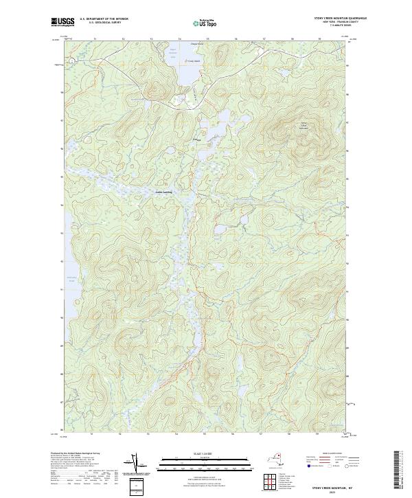
2023 Map of Stony Creek Mountain
USGS Topo · Published 2023About this map
The Raquette River winds through the heart of this Franklin County landscape, marking a historic corridor of travel within the Adirondack Park. The area is defined by its intricate network of waterways and portage routes, notably the Indian Carry Trl which connects Upper Saranac Lake toward the river valley. Small outposts like Coreys and Axton Landing serve as points of interest for those tracing the history of wilderness navigation and early regional settlement.
Find a feature on this map
36 named features on this map. Tap any name to fly to it.
Don’t see what you’re looking for? This feature index may not catch every label — zoom into the map to look around manually.
Map Details
Editions of this 2023 Stony Creek Mountain Map
This is the sole edition of this map. No revisions or reprints were ever made.
Other maps of this area

1902 · Saranac
USGS Topo · 1:62,500

1904 · Saranac
USGS Topo · 1:62,500

1904 · Santanoni
USGS Topo · 1:62,500

1904 · Long Lake
USGS Topo · 1:62,500

1905 · Saint Regis
USGS Topo · 1:62,500

1948 · Ogdensburg
USGS Topo · 1:250,000

1951 · Ogdensburg
USGS Topo · 1:250,000

1953 · Ogdensburg
USGS Topo · 1:250,000

1953 · Santanoni
USGS Topo · 1:62,500

1955 · Long Lake
USGS Topo · 1:62,500