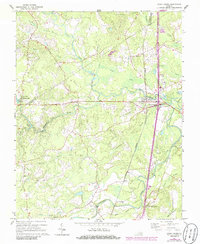
1967 Map of Stony Creek
USGS Topo · Published 1986About this map
The village of Stony Creek serves as a focal point in this portion of the Virginia coastal plain, situated where the Seaboard railroad and major roadways cross the namesake waterway. The landscape is defined by an intricate network of swamps and slow-moving streams, including Peaquarter Swamp, Southwest Swamp, and the winding Nottoway River along the southern edge. These drainage patterns influenced early settlement and industry, as seen at Winfields Mill and the adjacent Winfields Millpond.
Find a feature on this map
34 named features on this map. Tap any name to fly to it.
Don’t see what you’re looking for? This feature index may not catch every label — zoom into the map to look around manually.
Map Details
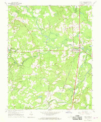
Editions of this 1967 Stony Creek Map
3 editions found
Other maps of this area

1894 · Petersburg
USGS Topo · 1:62,500

1897 · Amelia
USGS Topo · 1:125,000

1919 · Jarratt
USGS Topo · 1:62,500

1919 · Mc Kenney
USGS Topo · 1:48,000

1921 · Mc Kenney
USGS Topo · 1:62,500

1943 · Mc Kenney
USGS Topo · 1:62,500

1943 · Dinwiddie
USGS Topo · 1:24,000

1943 · Richmond
USGS Topo · 1:250,000

1944 · Reams
USGS Topo · 1:31,680
1944 · Dinwiddie
USGS Topo · 1:31,680