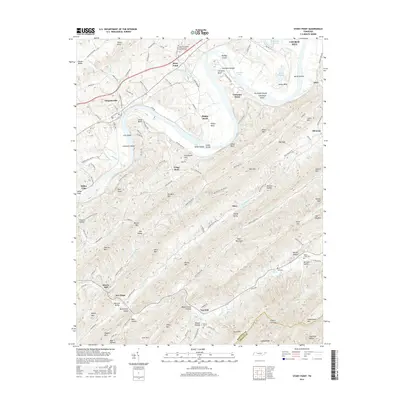
2016 Map of Stony Point
USGS Topo · Published 2016About this map
The Holston River winds through the heart of this East Tennessee landscape, creating a series of deep bends and islands such as Phipps Bend and Christian Islands. The river's path defines the settlement patterns of Hawkins County, where historic communities like Surgoinsville and Stony Point established themselves along the northern banks. Further south, the terrain rises sharply into the ridgelines of Bays Mountain, a dominant geographic feature that separates the river valley from the more isolated hollows and gaps of the backcountry.
Find a feature on this map
144 named features on this map. Tap any name to fly to it.
Don’t see what you’re looking for? This feature index may not catch every label — zoom into the map to look around manually.
Map Details
Editions of this 2016 Stony Point Map
This is the sole edition of this map. No revisions or reprints were ever made.
Other maps of this area

1892 · Greeneville
USGS Topo · 1:125,000

1894 · Estillville
USGS Topo · 1:125,000

1896 · Greeneville
USGS Topo · 1:125,000

1904 · Greeneville
USGS Topo · 1:125,000

1935 · Surgoinsville
USGS Topo · 1:48,000

1935 · Baileyton
USGS Topo · 1:24,000

1935 · Lovelace
USGS Topo · 1:24,000

1935 · Moggasin
USGS Topo · 1:48,000

1935 · Looneys Gap
USGS Topo · 1:24,000

1935 · McCloud
USGS Topo · 1:24,000