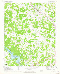
1970 Map of Stony Point
USGS Topo · Published 1973About this map
The Alexander RR cuts through the northern landscape of this Alexander and Iredell County border region, serving the community of Stony Point. Further south, the Catawba River is harnessed at the Lookout Shoals Dam, creating the wide expanse of Lookout Shoals Lake. This water feature defines the southwestern corner of the area, where Sunrise Beach and a local powerplant mark the industrial and recreational utility of the river during the early 1970s.
Find a feature on this map
50 named features on this map. Tap any name to fly to it.
Don’t see what you’re looking for? This feature index may not catch every label — zoom into the map to look around manually.
Map Details
Editions of this 1970 Stony Point Map
2 editions found
Other maps of this area

1893 · Statesville
USGS Topo · 1:125,000

1895 · Hickory
USGS Topo · 1:125,000

1953 · Charlotte
USGS Topo · 1:250,000

1954 · Charlotte
USGS Topo · 1:250,000

1960 · Charlotte
USGS Topo · 1:250,000

1962 · Charlotte
USGS Topo · 1:250,000

1969 · Troutman
USGS Topo · 1:24,000

1969 · Statesville West
USGS Topo · 1:24,000
1969 · Central
USGS Topo · 1:24,000
1970 · Hiddenite
USGS Topo · 1:24,000