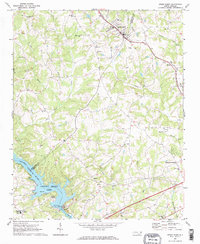
1970 Map of Stony Point
USGS Topo · Published 1973About this map
The Southern railroad line anchors the northern corridor of this landscape, passing directly through Stony Point and Scotts as it carries freight across the Piedmont. The southern portion is dominated by the sprawling reaches of Lookout Shoals Lake, an impoundment of the Catawba River controlled by the Lookout Shoals Dam and its adjacent powerplant. This 1970s view reveals a rural infrastructure defined by numerous community churches and crossroads, such as Philadelphia Ch and New Amity Ch, which served the scattered farmsteads and small settlements. The terrain is deeply etched by a network of waterways including Third Creek and Buffalo Shoals Creek, illustrating the natural drainage patterns that shaped local land use before modern development. Notable local landmarks like Bunker Hill High Sch and several cemeteries provide vital points of reference for those tracing family history in these rural townships.
Find a feature on this map
48 named features on this map. Tap any name to fly to it.
Don’t see what you’re looking for? This feature index may not catch every label — zoom into the map to look around manually.
Map Details
Editions of this 1970 Stony Point Map
2 editions found
Other maps of this area

1893 · Statesville
USGS Topo · 1:125,000

1895 · Hickory
USGS Topo · 1:125,000

1953 · Charlotte
USGS Topo · 1:250,000

1954 · Charlotte
USGS Topo · 1:250,000

1960 · Charlotte
USGS Topo · 1:250,000

1962 · Charlotte
USGS Topo · 1:250,000

1969 · Troutman
USGS Topo · 1:24,000

1969 · Statesville West
USGS Topo · 1:24,000
1969 · Central
USGS Topo · 1:24,000
1970 · Hiddenite
USGS Topo · 1:24,000