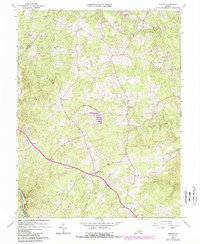
1966 Map of Storck
USGS Topo · Published 1984About this map
The Fauquier and Culpeper county lines converge along the western edge of this Stafford County landscape, where the Rappahannock River cuts through the southwestern corner. In the mid-1960s, the area remained a network of rural crossroads and family-named settlements like Heflin, Dodds Corner, and Skidmore Corner. Central to the community are landmarks such as Hartwood and Storck, with local spiritual life centered around Richland Ch and Mt Olive Ch. The terrain is deeply etched by a complex drainage system including Aquia Creek and Potomac Run, which define the local topography. This edition also highlights later developments from the early 1980s, such as the Little Lake Arrowhead area and the sprawling Glen Haven Memory Gardens, reflecting the gradual transition of this Virginia countryside toward more modern land use patterns while still maintaining its traditional rural structure.
Find a feature on this map
32 named features on this map. Tap any name to fly to it.
Don’t see what you’re looking for? This feature index may not catch every label — zoom into the map to look around manually.
Map Details
Editions of this 1966 Storck Map
4 editions found
Other maps of this area

1887 · Spottsylvania
USGS Topo · 1:125,000

1889 · Fredericksburg
USGS Topo · 1:125,000

1890 · Mt. Vernon
USGS Topo · 1:125,000

1891 · Mt. Vernon
USGS Topo · 1:125,000

1892 · Fredericksburg
USGS Topo · 1:125,000

1892 · Spottsylvania
USGS Topo · 1:125,000

1894 · Warrenton
USGS Topo · 1:125,000

1894 · Fredericksburg
USGS Topo · 1:125,000

1894 · Mt. Vernon
USGS Topo · 1:125,000

1897 · Mt. Vernon
USGS Topo · 1:125,000