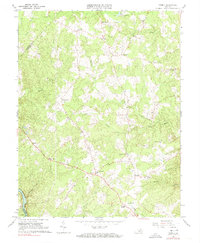
1966 Map of Storck
USGS Topo · Published 1974About this map
Storck and Hartwood anchor this mid-1960s survey of Stafford County, where the rural landscape is defined by its deep drainages and scattered community centers. The terrain is marked by numerous family-named junctions such as Dodds Corner, Skidmore Corner, and Paynes Corner, reflecting a traditional settlement pattern based on road intersections and church congregations. Religious life is well-documented through local landmarks including Grace Ch, Rock Hill Ch, and Richland Ch.
Find a feature on this map
33 named features on this map. Tap any name to fly to it.
Don’t see what you’re looking for? This feature index may not catch every label — zoom into the map to look around manually.
Map Details
Editions of this 1966 Storck Map
4 editions found
Other maps of this area

1887 · Spottsylvania
USGS Topo · 1:125,000

1889 · Fredericksburg
USGS Topo · 1:125,000

1890 · Mt. Vernon
USGS Topo · 1:125,000

1891 · Mt. Vernon
USGS Topo · 1:125,000

1892 · Fredericksburg
USGS Topo · 1:125,000

1892 · Spottsylvania
USGS Topo · 1:125,000

1894 · Warrenton
USGS Topo · 1:125,000

1894 · Fredericksburg
USGS Topo · 1:125,000

1894 · Mt. Vernon
USGS Topo · 1:125,000

1897 · Mt. Vernon
USGS Topo · 1:125,000