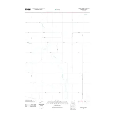
2013 Map of Storm Lake NE
USGS Topo · Published 2013About this map
The N Raccoon River defines the drainage pattern of this agricultural landscape in northeast Buena Vista County, winding south through a network of section-line roads. Small community hubs like Racine and Crozier appear as quiet points in the vast grid, reflecting the rural settlement patterns typical of this part of Iowa. The local hydrology is further shaped by Poor Farm Cr and engineered waterways like Lateral Number 2, which support the intensive cultivation of the surrounding plains. This 2013 survey provides a detailed look at the modern rural infrastructure, showing how the original township lines have evolved into a primary transportation network of numbered streets and avenues that connect these isolated agricultural settlements.
Find a feature on this map
24 named features on this map. Tap any name to fly to it.
Don’t see what you’re looking for? This feature index may not catch every label — zoom into the map to look around manually.
Map Details
Editions of this 2013 Storm Lake NE Map
This is the sole edition of this map. No revisions or reprints were ever made.
Other maps of this area

1954 · Fort Dodge
USGS Topo · 1:250,000

1957 · Fort Dodge
USGS Topo · 1:250,000

1958 · Fort Dodge
USGS Topo · 1:250,000

1971 · Sioux Rapids SE
USGS Topo · 1:24,000

1971 · Albert City
USGS Topo · 1:24,000

1971 · Rembrandt
USGS Topo · 1:24,000

1979 · Lakeside
USGS Topo · 1:24,000

1979 · Storm Lake
USGS Topo · 1:24,000

1979 · Varina
USGS Topo · 1:24,000

1979 · Newell West
USGS Topo · 1:24,000