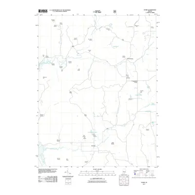
2011 Map of Story
USGS Topo · Published 2011About this map
The Middle Fork Salt Creek and Little Salt Creek drain a complex landscape of ridges and hollows in this 2011 survey of southern Indiana. The settlement of Story sits at a crossroads of the northern valley, while Houston serves as a southern anchor near Berry Branch Lake. The area's genealogical depth is reflected in numerous family burial grounds, including the Moffitt Cemetery, McKinney Cemetery, and Thompson Cemetery, which are scattered throughout the tributary valleys. Historically significant landmarks like the Cherry Hill Airport near Spurgeons Corner and the Treaty Line Pond suggest the intersection of modern utility and older jurisdictional boundaries. The terrain is defined by named high points such as Oak Ridge and Bald Knobs, alongside specialized topographic features like the Hominy Mortar and Nebo Ridge, illustrating the deep local nomenclature of Brown County.
Find a feature on this map
62 named features on this map. Tap any name to fly to it.
Don’t see what you’re looking for? This feature index may not catch every label — zoom into the map to look around manually.
Map Details
Editions of this 2011 Story Map
This is the sole edition of this map. No revisions or reprints were ever made.
Other maps of this area

1934 · Bedford
USGS Topo · 1:48,000

1937 · Bedford
USGS Topo · 1:62,500

1942 · Franklin
USGS Topo · 1:125,000

1946 · Belmont
USGS Topo · 1:24,000

1947 · Nashville
USGS Topo · 1:24,000

1947 · Elkinsville
USGS Topo · 1:24,000

1948 · New Bellsville
USGS Topo · 1:24,000

1948 · Waymansville
USGS Topo · 1:24,000

1949 · Nashville
USGS Topo · 1:24,000

1950 · Belmont
USGS Topo · 1:24,000