
1949 Map of Nashville
USGS Topo · Published 1949About this map
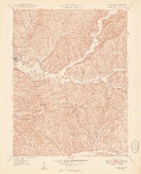
The town of Nashville serves as the hub of this 1940s survey, situated at the confluence of Greasy Creek and the North Fork Salt Creek. The map documents a transition in land use, showing the established village grid alongside the expanding footprint of Brown County State Park. Within the park, significant elevation is reached at Weed Patch Hill, which features a lookout tower, a companion to the Lilly Lookout Tower further north.
Find a feature on this map
55 named features on this map. Tap any name to fly to it.
Don’t see what you’re looking for? This feature index may not catch every label — zoom into the map to look around manually.
Map Details
Editions of this 1949 Nashville Map
2 editions found
Other maps of this area

1942 · Franklin
USGS Topo · 1:125,000

1946 · Belmont
USGS Topo · 1:24,000

1947 · Nashville
USGS Topo · 1:24,000

1947 · Elkinsville
USGS Topo · 1:24,000

1947 · Franklin
USGS Topo · 1:62,500

1948 · New Bellsville
USGS Topo · 1:24,000

1948 · Waymansville
USGS Topo · 1:24,000

1948 · Nineveh
USGS Topo · 1:24,000

1948 · Fruitdale
USGS Topo · 1:24,000

1948 · Morgantown
USGS Topo · 1:24,000