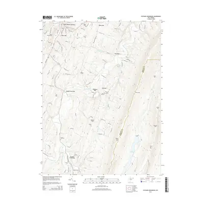
2014 Map of Stotlers Crossroads
USGS Topo · Published 2014About this map
Bath (Berkeley Springs) serves as the northern anchor of this landscape, where the historic town's layout meets the rising terrain of Warm Springs Ridge. The geography here is defined by long, parallel ridges and hollows characteristic of the Appalachian Valley and Ridge province, with Sleepy Creek and its tributaries like Middle Fork Sleepy Cr carving through the valley floors. In the southern portion of the map, the namesake Stotlers Crossroads marks a key junction of local routes near the banks of S Fork Sleepy Cr. Genealogists will find a high density of burial sites throughout the rural countryside, including Ambrose Chapel Cem, Highland Ridge Cem, and Mt Olivet Cem. The eastern edge is dominated by the steep ascent of Sleepy Creek Mtn, a significant topographic barrier separating this valley from the neighboring Berkeley County line.
Find a feature on this map
54 named features on this map. Tap any name to fly to it.
Don’t see what you’re looking for? This feature index may not catch every label — zoom into the map to look around manually.
Map Details
Editions of this 2014 Stotlers Crossroads Map
This is the sole edition of this map. No revisions or reprints were ever made.
Other maps of this area

1894 · Winchester
USGS Topo · 1:125,000

1898 · Paw Paw
USGS Topo · 1:62,500

1899 · Hancock
USGS Topo · 1:62,500

1900 · Pawpaw
USGS Topo · 1:62,500

1901 · Hancock
USGS Topo · 1:62,500

1910 · Paw Paw
USGS Topo · 1:62,500

1914 · Gerrardstown
USGS Topo · 1:48,000

1916 · Gerrardstown
USGS Topo · 1:62,500

1916 · Capon Bridge
USGS Topo · 1:62,500

1923 · Capon Bridge
USGS Topo · 1:62,500