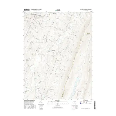
2016 Map of Stotlers Crossroads
USGS Topo · Published 2016About this map
Highland Ridge dominates the central landscape of this West Virginia study, where narrow valleys and parallel ridges define the settlement patterns of Morgan and Berkeley Counties. The southern end of the sheet is anchored by Stotlers Crossroads, a nexus of local roads near the Middle Fork Sleepy Cr. Moving north, the importance of water power and early industry is evident at Johnsons Mill on Sleepy Creek. Genealogy interest is high throughout this corridor, with numerous burial grounds such as Mount Olivet Cem and Ambrose Chapel Cem situated along the winding rural routes. The eastern edge is marked by the steep ascent of Sleepy Creek Mtn, where the Tuscarora Trail follows the ridge line, while the northwestern corner reveals the southern reaches of Berkeley Springs and Berryville along the corridor of Us Rte 522.
Find a feature on this map
41 named features on this map. Tap any name to fly to it.
Don’t see what you’re looking for? This feature index may not catch every label — zoom into the map to look around manually.
Map Details
Editions of this 2016 Stotlers Crossroads Map
This is the sole edition of this map. No revisions or reprints were ever made.
Other maps of this area

1894 · Winchester
USGS Topo · 1:125,000

1898 · Paw Paw
USGS Topo · 1:62,500

1899 · Hancock
USGS Topo · 1:62,500

1900 · Pawpaw
USGS Topo · 1:62,500

1901 · Hancock
USGS Topo · 1:62,500

1910 · Paw Paw
USGS Topo · 1:62,500

1914 · Gerrardstown
USGS Topo · 1:48,000

1916 · Gerrardstown
USGS Topo · 1:62,500

1916 · Capon Bridge
USGS Topo · 1:62,500

1923 · Capon Bridge
USGS Topo · 1:62,500