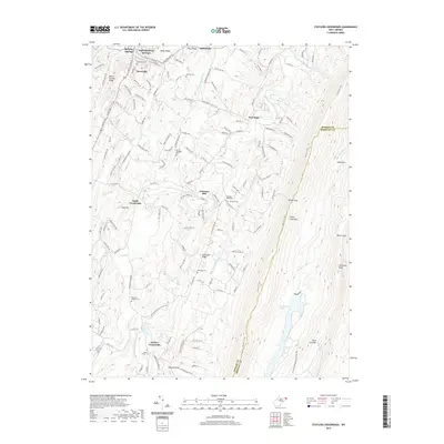
2019 Map of Stotlers Crossroads
USGS Topo · Published 2019About this map
Bath (Berkeley Springs) serves as the northern anchor for this landscape, where the historic town and Berkeley Springs sit at the base of Warm Springs Ridge. This map illustrates the intricate relationship between the mountainous topography and small-scale settlements that define Morgan County. The terrain is marked by a series of north-south ridges including Horse Ridge and Pious Ridge, which channel the waters of Sleepy Creek and its various forks toward the Potomac River. Throughout the valley, rural life is documented by numerous community landmarks such as Johnsons Mill and crossroads like Stotlers Crossroads. Genealogists will find significant value in the distribution of family and community burial grounds, from Highland Ridge Cem and Duckwall Cem in the central hills to Ambrose Chapel Cem and Mount Olivet Cem further south.
Find a feature on this map
57 named features on this map. Tap any name to fly to it.
Don’t see what you’re looking for? This feature index may not catch every label — zoom into the map to look around manually.
Map Details
Editions of this 2019 Stotlers Crossroads Map
This is the sole edition of this map. No revisions or reprints were ever made.
Other maps of this area

1894 · Winchester
USGS Topo · 1:125,000

1898 · Paw Paw
USGS Topo · 1:62,500

1899 · Hancock
USGS Topo · 1:62,500

1900 · Pawpaw
USGS Topo · 1:62,500

1901 · Hancock
USGS Topo · 1:62,500

1910 · Paw Paw
USGS Topo · 1:62,500

1914 · Gerrardstown
USGS Topo · 1:48,000

1916 · Gerrardstown
USGS Topo · 1:62,500

1916 · Capon Bridge
USGS Topo · 1:62,500

1923 · Capon Bridge
USGS Topo · 1:62,500