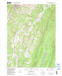
1998 Map of Stotlers Crossroads
USGS Topo · Published 1999About this map
Sleepy Creek carves a winding path through this portion of Morgan County, defining the valley between Pious Ridge and the forested slopes of Third Hill Mountain. The landscape in the late 1990s remained primarily rural, with small communities like Stotlers Crossroads and Johnsons Mill serving as local anchors. A cluster of historic religious and educational sites, including Ambrose Chapel and the Highland School, suggests a long-standing pattern of dispersed mountain settlements. Near Berkeley Springs, the presence of a Drive-in Theater and a local Substation reflects the gradual modernization of the corridor along Warm Spring Run. Much of the eastern terrain is dedicated to the Sleepy Creek Wildlife Management Area, where the Sleepy Creek Lookout Tower stands atop the ridge, overlooking the drainage of Meadow Branch.
Find a feature on this map
48 named features on this map. Tap any name to fly to it.
Don’t see what you’re looking for? This feature index may not catch every label — zoom into the map to look around manually.
Map Details
Editions of this 1998 Stotlers Crossroads Map
This is the sole edition of this map. No revisions or reprints were ever made.
Other maps of this area

1894 · Winchester
USGS Topo · 1:125,000

1898 · Paw Paw
USGS Topo · 1:62,500

1899 · Hancock
USGS Topo · 1:62,500

1900 · Pawpaw
USGS Topo · 1:62,500

1901 · Hancock
USGS Topo · 1:62,500

1910 · Paw Paw
USGS Topo · 1:62,500

1914 · Gerrardstown
USGS Topo · 1:48,000

1916 · Gerrardstown
USGS Topo · 1:62,500

1916 · Capon Bridge
USGS Topo · 1:62,500

1923 · Capon Bridge
USGS Topo · 1:62,500