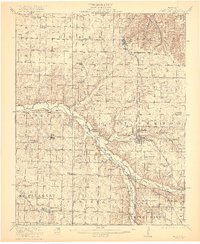
1921 Map of Stotts City
USGS Topo · Published 1921About this map
Mt Vernon serves as a prominent anchor for this portion of Lawrence County, notably featuring the State Sanitarium and the nearby County Farm. The landscape is defined by the winding course of the Spring River and its tributaries, including Honey Creek and Center Creek. In the southwest, the community of Freistatt is established near the German Church, while Stotts City sits along the Missouri Pacific railroad line.
Find a feature on this map
61 named features on this map. Tap any name to fly to it.
Don’t see what you’re looking for? This feature index may not catch every label — zoom into the map to look around manually.
Map Details
Editions of this 1921 Stotts City Map
2 editions found
Other maps of this area

1886 · Greenfield
USGS Topo · 1:125,000

1886 · Carthage
USGS Topo · 1:125,000

1888 · Greenfield
USGS Topo · 1:125,000

1894 · Carthage
USGS Topo · 1:125,000

1919 · Halltown
USGS Topo · 1:62,500

1921 · Stotts City
USGS Topo · 1:62,500

1921 · Sarcoxie
USGS Topo · 1:62,500

1942 · Aurora
USGS Topo · 1:62,500

1943 · Ritchey
USGS Topo · 1:62,500

1943 · Monett
USGS Topo · 1:62,500